Pembuatan Peta Sebaran Penyakit melalui Workshop Sistem Informasi Geografis
Keywords:
Workshop, SIG, disease distribution map, Geographic Information SystemAbstract
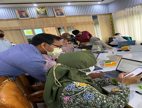
The problem that often arises and is commonly found in the implementation of health planning at the health office is that the health planning system is still less effective in covering the needs and problems related to the health of the local community. The purpose of this Community Service (PKM) activity is to increase knowledge and skills in making disease distribution maps using the Quantum GIS application as one of the tools for making health plans. The training method is carried out by simulation and direct practice. The participants of this training were as many as 16 staff of Disease Control and Eradication the Jambi Provincial Health Office (P2P). Evaluation of activities using a pre-posttest questionnaire. The knowledge of P2P officers before training was dominantly lacking (43.8%) and after training the knowledge became dominantly good (75%). The results of this activity were obtained by increasing the knowledge and skills of P2P officers in making disease distribution maps using the QGIS application.
References
Barkey, R. A., Achmad, A., Rijal, S., Soma, A. S., & Talebe, A. B. (2009). Buku Ajar Sistem Informasi Spasial Kehutanan Tim : Laboratorium Perencanaan Dan Universitas Hasanuddin Oktober 2009. Fakultas Kehutanan Universitas Hasanuddin. https://forestry.unhas.ac.id/wp-content/uploads/2020/06/4_sistem_informasi_spasial_kehutanan.pdf
Farida, O. A., & Rosalina, F. (2022). Pelatihan Dasar Sistem Informasi Geografis Menggunakan Software Mapinfo. Jurnal Pengabdian Mandiri, 1(2), 75–82. https://bajangjournal.com/index.php/JPM/article/view/1538
Gilbert, R., & Cliffe, S. J. (2016). Public Health Surveillance. Public Health Intelligence, 91. https://doi.org/10.1007/978-3-319-28326-5_5
Groseclose, S. L., & Buckeridge, D. L. (2017). Public Health Surveillance Systems: Recent Advances in Their Use and Evaluation. Annual Review of Public Health, 38, 57–79. https://doi.org/10.1146/annurev-publhealth-031816-044348
Khashoggi, B. F., & Murad, A. (2020). Issues of Healthcare Planning and GIS : A Review. International Journal of Geo-Information, 9(352). https://www.mdpi.com/726924
Krishna, B. (2021). Disease Surveillance: The Bedrock for Control and Prevention. Indian Journal of Critical Care Medicine : Peer-Reviewed, Official Publication of Indian Society of Critical Care Medicine, 25(7), 745. https://doi.org/10.5005/JP-JOURNALS-10071-23908
Kusumadewi, Sri, & Fauzijah, A. (2009). Informatika Kesehatan (1st ed.). Yogyakarta: Graha Ilmu. Retreived from https://opac.perpusnas.go.id/DetailOpac.aspx?id=709798
Mphande, F. A. (2016). Surveillance. Infectious Diseases and Rural Livelihood in Developing Countries, 115. https://doi.org/10.1007/978-981-10-0428-5_7
Mullner, R. M., Chung, K., Croke, K. G., & Mensah, E. K. (2004). Geographic information systems in public health and medicine. Journal of Medical Systems, 28(3), 215–221. https://doi.org/10.1023/B:JOMS.0000032972.29060.DD
Musa, G. J., Chiang, P. H., Sylk, T., Bavley, R., Keating, W., Lakew, B., Tsou, H. C., & Hoven, C. W. (2013). Use of GIS Mapping as a Public Health Tool—From Cholera to Cancer. Health Services Insights, 6, 111. https://doi.org/10.4137/HSI.S10471
Noah, N. (2021). Surveillance of Infectious Diseases. Encyclopedia of Virology, 247. https://doi.org/10.1016/B978-0-12-814515-9.00068-0
Nsubuga, P., White, M. E., Thacker, S. B., Anderson, M. A., Blount, S. B., Broome, C. V., Chiller, T. M., Espitia, V., Imtiaz, R., Sosin, D., Stroup, D. F., Tauxe, R. V., Vijayaraghavan, M., & Trostle, M. (2006). Public Health Surveillance: A Tool for Targeting and Monitoring Interventions. Disease Control Priorities in Developing Countries, 997–1015. https://www.ncbi.nlm.nih.gov/books/NBK11770/
Prahasta, E. (2014). Sistem Informasi Geografis : Konsep-Konsep Dasar (Perspektif Geodesi dan Geomatika) (1st ed.). Penerbit Informatika.
Pramatama, S., Wijayanti, M., Octaviana, D., Anandari, D., Masyarakat, J. K., Universitas, K., & Soedirman, J. (2019). Aplikasi Tehnologi Sistem Informasi Geografis untuk Meningkatkan Sistem Surveilans Penyakit Menular di Kabupaten Banyumas. Jurnal Abdimas, 22(2), 221–226. https://doi.org/10.15294/abdimas.v22i2.15780
Richards, C. L., Iademarco, M. F., Atkinson, D., Pinner, R. W., Yoon, P., Mac Kenzie, W. R., Lee, B., Qualters, J. R., & Frieden, T. R. (2017). Advances in Public Health Surveillance and Information Dissemination at the Centers for Disease Control and Prevention. Public Health Reports, 132(4), 403. https://doi.org/10.1177/0033354917709542
Sigit, N., & Imam, C. W. (2022). Penyuluhan Kader Kesehatan dalam Pemanfaatan Sistem Informasi Geografis (SIG) Kaitannya dalam Pemetaan Sebaran Demam Berdarah di Dusun Sukosari Desa Pandansari, Poncokusumo, Kabupaten Malang. SELAPARANG Jurnal Pengabdian Masyarakat Berkemajuan, 6(1), 65–68. https://doi.org/10.31764/JPMB.V6I1.7226
Smida, J., Loosova, J., Prattingerova, J., Zabka, V., Vrbik, D., Harman, J., Vaclavikova, L., & Sembera, J. (2020). Digital epidemiology supported by GIS as a way for effective communication of the epidemic situation. The European Journal of Public Health, 30(Suppl 5). https://doi.org/10.1093/EURPUB/CKAA165.441
Tulchinsky, T. H. (2018). John Snow, Cholera, the Broad Street Pump; Waterborne Diseases Then and Now. Case Studies in Public Health, 77. https://doi.org/10.1016/B978-0-12-804571-8.00017-2
Walford, N. S. (2020). Demographic and social context of deaths during the 1854 cholera outbreak in Soho, London: a reappraisal of Dr John Snow’s investigation. In Health & place (Vol. 65, p. 102402). https://doi.org/10.1016/j.healthplace.2020.102402
Wang, F. (2020). Why Public Health Needs GIS: A MethodologicalOverview. Annals of GIS, 26(1), 1. https://doi.org/10.1080/19475683.2019.1702099
Published
How to Cite
Issue
Section
Copyright (c) 2023 Muhammad Syukri, Rd. Halim, Rizalia Wardiah

This work is licensed under a Creative Commons Attribution-ShareAlike 4.0 International License.
Authors who publish with Poltekita: Jurnal Pengabdian Masyarakat agree to the following terms:
- Authors retain copyright and grant the journal right of first publication with the work simultaneously licensed under a Creative Commons Attribution License (CC BY-SA 4.0) that allows others to share the work with an acknowledgment of the work's authorship and initial publication in this journal.
- Authors are able to enter into separate, additional contractual arrangements for the non-exclusive distribution of the journal's published version of the work (e.g., post it to an institutional repository or publish it in a book), with an acknowledgment of its initial publication in this journal.
- Authors are permitted and encouraged to post their work online (e.g., in institutional repositories or on their website) prior to and during the submission process, as it can lead to productive exchanges, as well as earlier and greater citation of published work.

This work is licensed under a Creative Commons Attribution-Share Alike 4.0 International License
You are free to:
- Share, copy and redistribute the material in any medium or format
- Adapt, remix, transform, and build upon the material for any purpose, even commercially.
- The licensor cannot revoke these freedoms as long as you follow the license terms.
1.png)